Hi,
There is a problem exporting the track and there are several devices that do not capture the entire track in Cybertracker. It has already been checked. It is not a cloudiness issue. The points that are sent with data are marked, but we want them to capture the track.
Hi Andres,
Are you using CyberTracker Classic?
This looks like QGIS. I cannot tell from the view what you are expecting it to look like.
Thanks
Yes, it’s Cybertracker Classic.
I’m having this problem; it doesn’t capture the integrated route track.
image|690x387
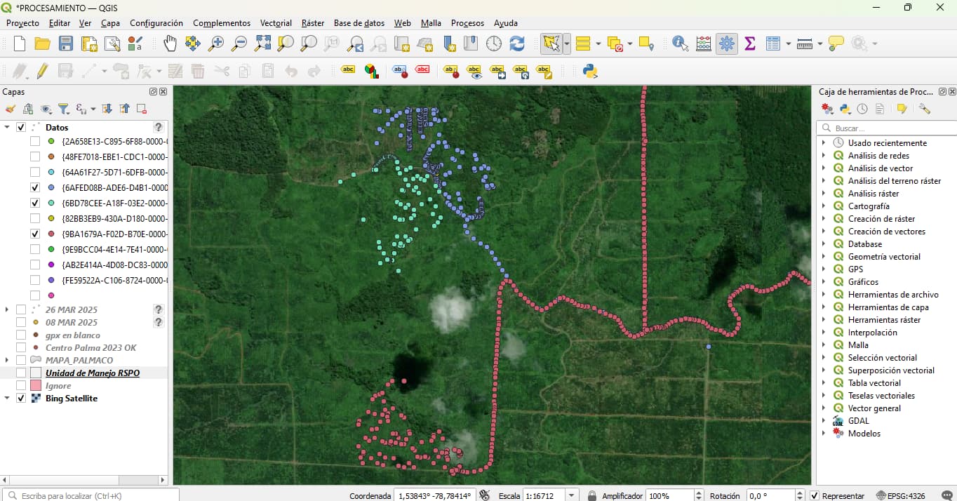
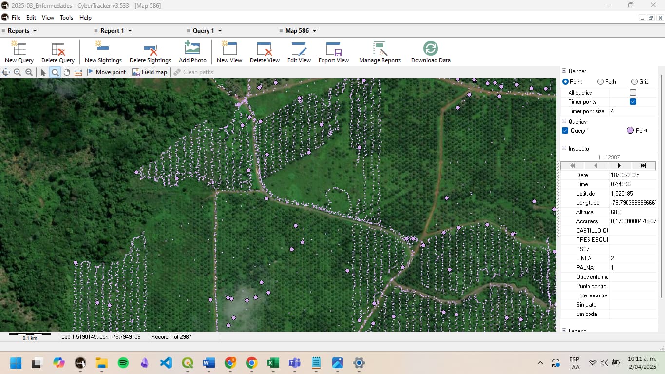
This is an example of what I want, the full track, with the logs, but as you can see in QGIS, I have waypoints that are intersecting.
image|690x387
Do you know how the export to QGIS works? It looks like the data is in CyberTracker, so perhaps there is an error during the transfer to QGIS…
HI
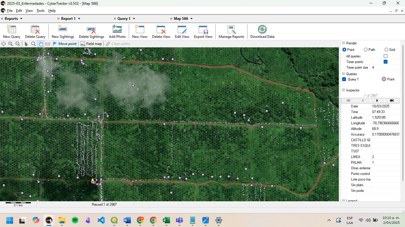
We believe it is a problem with the integrated track, the data marked with information is captured, but the track that captures the point by time intervals (like a GPS) is not doing it well, not all of them but several, and in different forms and cell phone models, we also tried with other versions of QGIS, it is as if it does not take the point of the interval
Hi Andres,
I think there is some confusion. CyberTracker and QGIS are different applications and are generally unrelated.
If you are saying that on some devices that CyberTracker tracks are incomplete, we will need bug reports from one of those devices. The bug report can be created from the bottom of the Settings page on the CyberTracker mobile app.
Thanks